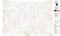
1981 Map of High Rock Canyon
USGS Topo · Published 1981About this map
High Rock Canyon carves a path through the northwestern Nevada landscape as it appeared in the early 1980s, serving as a focal point for a region defined by remote outposts and ancient geology. The map documents the high-desert terrain where the Slumgullion Range and Black Rock Range meet the northern edge of the Black Rock Desert. This area is marked by historical remnants like the Leadville (Site) and isolated waypoints such as Powers Well and Jims.
Find a feature on this map
67 named features on this map. Tap any name to fly to it.
Don’t see what you’re looking for? This feature index may not catch every label — zoom into the map to look around manually.
Map Details
Editions of this 1981 High Rock Canyon Map
2 editions found
Other maps of this area

1886 · Alturas
USGS Topo · 1:250,000

1886 · Honey Lake
USGS Topo · 1:250,000

1886 · Disaster
USGS Topo · 1:250,000

1886 · Granite Range
USGS Topo · 1:250,000

1889 · Long Valley
USGS Topo · 1:250,000

1891 · Honey Lake
USGS Topo · 1:250,000

1892 · Alturas
USGS Topo · 1:250,000

1893 · Honey Lake
USGS Topo · 1:250,000

1893 · Disaster
USGS Topo · 1:250,000

1894 · Granite Range
USGS Topo · 1:250,000