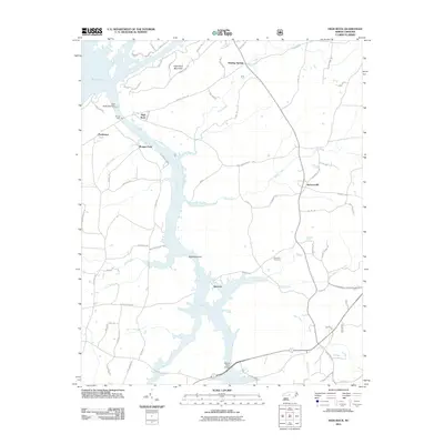
2011 Map of High Rock
USGS Topo · Published 2011About this map
The Yadkin River shapes the geography of this Davidson County landscape, serving as the central artery for the communities of High Rock, Newsom, and Jackson Hill. This 2011 edition documents the intricate shoreline of the reservoir formed by the High Rock Lake Dam, where multiple tributaries like Flat Swamp Creek, Lick Creek, and Cabin Creek converge. The topography is defined by the prominent rises of High Rock Mountain and Bald Mountain, which overlook a mix of lakeside residential development and rural farmland.
Find a feature on this map
75 named features on this map. Tap any name to fly to it.
Don’t see what you’re looking for? This feature index may not catch every label — zoom into the map to look around manually.
Map Details
Editions of this 2011 High Rock Map
This is the sole edition of this map. No revisions or reprints were ever made.
Other maps of this area

1949 · High Rock
USGS Topo · 1:24,000

1949 · Denton NW
USGS Topo · 1:24,000

1953 · Charlotte
USGS Topo · 1:250,000

1954 · Charlotte
USGS Topo · 1:250,000

1957 · Mount Pleasant
USGS Topo · 1:62,500

1957 · Albemarle
USGS Topo · 1:62,500

1957 · Denton
USGS Topo · 1:62,500

1960 · Charlotte
USGS Topo · 1:250,000

1962 · Charlotte
USGS Topo · 1:250,000

1962 · Southmont
USGS Topo · 1:24,000