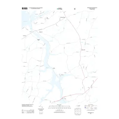
2013 Map of High Rock
USGS Topo · Published 2013About this map
High Rock Lake and the Tuckertown Reservoir dominate the western edge of this 2013 landscape, where the Yadkin River drainage shapes the local geography. Small settlements like High Rock, Pooletown, and Morgan Ford sit along these banks, indicating the historical importance of river access even as modern residential developments like Emerald Isle Ct and Harbor Dr E begin to spread across the lakefront. To the east, the terrain rises toward High Rock Mountain and Bald Mountain, creating a natural divide from the flatter agricultural lands near Healing Springs.
Find a feature on this map
81 named features on this map. Tap any name to fly to it.
Don’t see what you’re looking for? This feature index may not catch every label — zoom into the map to look around manually.
Map Details
Editions of this 2013 High Rock Map
This is the sole edition of this map. No revisions or reprints were ever made.
Other maps of this area

1949 · High Rock
USGS Topo · 1:24,000

1949 · Denton NW
USGS Topo · 1:24,000

1953 · Charlotte
USGS Topo · 1:250,000

1954 · Charlotte
USGS Topo · 1:250,000

1957 · Mount Pleasant
USGS Topo · 1:62,500

1957 · Albemarle
USGS Topo · 1:62,500

1957 · Denton
USGS Topo · 1:62,500

1960 · Charlotte
USGS Topo · 1:250,000

1962 · Charlotte
USGS Topo · 1:250,000

1962 · Southmont
USGS Topo · 1:24,000