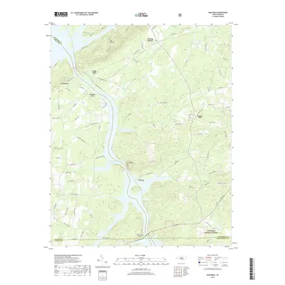
2019 Map of High Rock
USGS Topo · Published 2019About this map
Tuckertown Reservoir and the winding course of the Yadkin River define this landscape on the border of Davidson and Rowan counties. The map details a transition from the managed timberlands of the Uwharrie National Forest in the southeast to the rugged summits of High Rock Mtn and Bald Mtn. Local history is preserved in the location of several small communities, including the namesake High Rock, the crossroads of Jackson Hill, and the settlement at Healing Springs.
Find a feature on this map
81 named features on this map. Tap any name to fly to it.
Don’t see what you’re looking for? This feature index may not catch every label — zoom into the map to look around manually.
Map Details
Editions of this 2019 High Rock Map
This is the sole edition of this map. No revisions or reprints were ever made.
Other maps of this area

1949 · High Rock
USGS Topo · 1:24,000

1949 · Denton NW
USGS Topo · 1:24,000

1953 · Charlotte
USGS Topo · 1:250,000

1954 · Charlotte
USGS Topo · 1:250,000

1957 · Mount Pleasant
USGS Topo · 1:62,500

1957 · Albemarle
USGS Topo · 1:62,500

1957 · Denton
USGS Topo · 1:62,500

1960 · Charlotte
USGS Topo · 1:250,000

1962 · Charlotte
USGS Topo · 1:250,000

1962 · Southmont
USGS Topo · 1:24,000