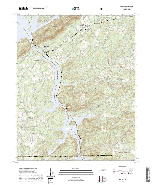
2022 Map of High Rock
USGS Topo · Published 2022About this map
Yadkin River and the Tuckertown Reservoir serve as the central geographic features of this North Carolina landscape, where the borders of Davidson, Rowan, Stanly, and Montgomery counties converge. The terrain is marked by significant elevations like High Rock Mtn and Bald Mtn, which overlook a network of rural settlements and family-named roads. The map highlights established communities such as Healing Springs, Jackson Hill, and Newsom, along with smaller locales like Pooletown and Morgan Ford.
Find a feature on this map
81 named features on this map. Tap any name to fly to it.
Don’t see what you’re looking for? This feature index may not catch every label — zoom into the map to look around manually.
Map Details
Editions of this 2022 High Rock Map
This is the sole edition of this map. No revisions or reprints were ever made.
Other maps of this area

1949 · High Rock
USGS Topo · 1:24,000

1949 · Denton NW
USGS Topo · 1:24,000

1953 · Charlotte
USGS Topo · 1:250,000

1954 · Charlotte
USGS Topo · 1:250,000

1957 · Mount Pleasant
USGS Topo · 1:62,500

1957 · Albemarle
USGS Topo · 1:62,500

1957 · Denton
USGS Topo · 1:62,500

1960 · Charlotte
USGS Topo · 1:250,000

1962 · Charlotte
USGS Topo · 1:250,000

1962 · Southmont
USGS Topo · 1:24,000