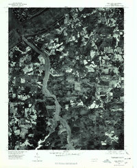
1977 Map of High Rock
USGS Topo · Published 1979About this map
The Yadkin River carves a central path through this landscape, defining the character of central North Carolina in the late 1970s. This orthophotoquad, created from imagery taken in March 1977, provides a literal overhead perspective of the rural field patterns and forested slopes surrounding High Rock Mountain. The settlement of High Rock sits at the northwestern bend of the river where it opens into High Rock Lake, showing the early footprint of development near the reservoir. Further east, the map details the layout of small communities like Healing Springs, Jackson Hill, and Newsom, each appearing as a collection of structures and clearings within the mosaic of agricultural plots. The orthophoto format allows for a direct visual study of land use, from the dense timber on the mountain ridges to the cultivated tracts that follow the river's winding course.
Find a feature on this map
7 named features on this map. Tap any name to fly to it.
Don’t see what you’re looking for? This feature index may not catch every label — zoom into the map to look around manually.
Map Details
Editions of this 1977 High Rock Map
This is the sole edition of this map. No revisions or reprints were ever made.
Other maps of this area

1949 · High Rock
USGS Topo · 1:24,000

1949 · Denton NW
USGS Topo · 1:24,000

1953 · Charlotte
USGS Topo · 1:250,000

1954 · Charlotte
USGS Topo · 1:250,000

1957 · Mount Pleasant
USGS Topo · 1:62,500

1957 · Albemarle
USGS Topo · 1:62,500

1957 · Denton
USGS Topo · 1:62,500

1960 · Charlotte
USGS Topo · 1:250,000

1962 · Charlotte
USGS Topo · 1:250,000

1962 · Southmont
USGS Topo · 1:24,000