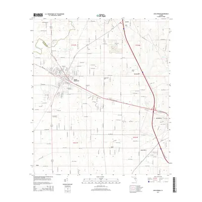
2015 Map of High Springs
USGS Topo · Published 2015About this map
High Springs serves as a central hub on this 2015 survey, situated at the junction of several critical transport routes including the CSX rail line and S US Highway 441. The landscape is defined by its karst hydrography, featuring significant groundwater sources like Columbia Spring and Hornsby Spring that feed the Santa Fe River along the northern border. Beyond the developed centers of Alachua and High Springs, the map documents smaller named localities such as Arno, Buda, and Traxler. For those researching local families, several established burial grounds are noted, including High Springs Cem, Asberry Cem, and the more isolated Cathcart Cem to the south. The terrain rises to distinct elevations at Spring Hill and Underwood Hill, offering a clear view of the rural and suburban character of this region during the mid-2010s.
Find a feature on this map
174 named features on this map. Tap any name to fly to it.
Don’t see what you’re looking for? This feature index may not catch every label — zoom into the map to look around manually.
Map Details
Editions of this 2015 High Springs Map
This is the sole edition of this map. No revisions or reprints were ever made.
Other maps of this area

1890 · Arredondo
USGS Topo · 1:62,500

1892 · Arredondo
USGS Topo · 1:62,500

1894 · Arredondo
USGS Topo · 1:62,500

1954 · Gainesville
USGS Topo · 1:250,000

1958 · Gainesville
USGS Topo · 1:250,000

1959 · Gainesville
USGS Topo · 1:250,000

1962 · High Springs
USGS Topo · 1:24,000

1962 · Mikesville
USGS Topo · 1:24,000
1966 · Worthington Springs
USGS Topo · 1:24,000

1966 · Gainesville West
USGS Topo · 1:24,000