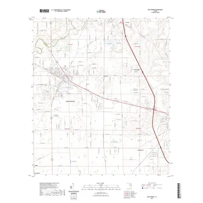
2021 Map of High Springs
USGS Topo · Published 2021About this map
The Santa Fe River winds across the northwestern corner of this Alachua County landscape, marking the natural boundary between Alachua and Columbia counties. This hydrologically unique area is characterized by subterranean water features such as Hornsby Spring, Columbia Spring, and the aptly named Suck Hole. The settlement of High Springs serves as a central hub, where the local street grid is defined by its rail history along NW Railroad Ave and SE Railroad Ave.
Find a feature on this map
88 named features on this map. Tap any name to fly to it.
Don’t see what you’re looking for? This feature index may not catch every label — zoom into the map to look around manually.
Map Details
Editions of this 2021 High Springs Map
This is the sole edition of this map. No revisions or reprints were ever made.
Other maps of this area

1890 · Arredondo
USGS Topo · 1:62,500

1892 · Arredondo
USGS Topo · 1:62,500

1894 · Arredondo
USGS Topo · 1:62,500

1954 · Gainesville
USGS Topo · 1:250,000

1958 · Gainesville
USGS Topo · 1:250,000

1959 · Gainesville
USGS Topo · 1:250,000

1962 · High Springs
USGS Topo · 1:24,000

1962 · Mikesville
USGS Topo · 1:24,000
1966 · Worthington Springs
USGS Topo · 1:24,000

1966 · Gainesville West
USGS Topo · 1:24,000