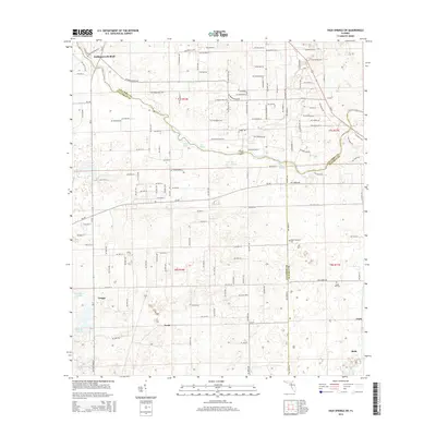
2015 Map of High Springs SW
USGS Topo · Published 2015About this map
The Santa Fe River winds through this North Central Florida landscape, serving as a natural boundary between Gilchrist, Columbia, and Alachua Counties. Along its banks, the region is defined by a distinct concentration of freshwater springs, including Ginnie Spring, Blue Springs, Lilly Spring, and Poe Spring, which have long served as local landmarks. The map documents several small, historic crossroads and agricultural communities such as Craggs, Neals, and Buda, reflecting the area's rural development. Inland from the river, the terrain is dotted with notable water bodies like Bay Horse Pond and Bagget Lake. For those researching family history, the map identifies localized sites such as Mount Pleasant Cem and Nobel Hill Cem, alongside long-standing place names like Hollingsworth Bluff and Rum Island, capturing the rural character of the region in the mid-2010s.
Find a feature on this map
142 named features on this map. Tap any name to fly to it.
Don’t see what you’re looking for? This feature index may not catch every label — zoom into the map to look around manually.
Map Details
Editions of this 2015 High Springs SW Map
This is the sole edition of this map. No revisions or reprints were ever made.
Other maps of this area

1954 · Gainesville
USGS Topo · 1:250,000

1958 · Gainesville
USGS Topo · 1:250,000

1959 · Gainesville
USGS Topo · 1:250,000

1962 · High Springs
USGS Topo · 1:24,000

1962 · Mikesville
USGS Topo · 1:24,000

1968 · Waters Lake
USGS Topo · 1:24,000

1968 · Newberry
USGS Topo · 1:24,000

1968 · Fourmile Lake
USGS Topo · 1:24,000
1968 · Hildreth
USGS Topo · 1:24,000
1968 · Bell
USGS Topo · 1:24,000