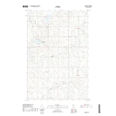
2019 Map of Highland
USGS Topo · Published 2019About this map
Highland and the surrounding township of Silver Creek define this portion of the North Shore highlands, where a complex network of waterways flows toward Lake Superior. The terrain is marked by the headwaters of the Gooseberry River, the Stewart River, and the Encampment River, interspersed with numerous small bodies of water like Thomas Lake and Highland Lake. The human footprint in this era is characterized by small, dispersed settlements such as Wales, Alger, and Lauren, connected by a mix of county roads and historic corridors like the N Shore State Trail. This landscape reflects a long history of recreational use and forest management, evidenced by the presence of the Sawmill Trl and Alger Grade W, tracing the routes of former industrial access roads that have since become part of the local trail system.
Find a feature on this map
33 named features on this map. Tap any name to fly to it.
Don’t see what you’re looking for? This feature index may not catch every label — zoom into the map to look around manually.
Map Details
Editions of this 2019 Highland Map
This is the sole edition of this map. No revisions or reprints were ever made.
Other maps of this area

1953 · Whyte
USGS Topo · 1:62,500

1954 · Mc Carthy Creek
USGS Topo · 1:24,000

1954 · Two Harbors
USGS Topo · 1:250,000

1956 · King Lake
USGS Topo · 1:24,000

1957 · Two Harbors
USGS Topo · 1:250,000

1957 · Two Harbors
USGS Topo · 1:62,500

1957 · Two Harbors
USGS Topo · 1:24,000

1957 · Brimson
USGS Topo · 1:62,500

1957 · Two Harbors NE
USGS Topo · 1:24,000

1957 · Castle Danger
USGS Topo · 1:24,000