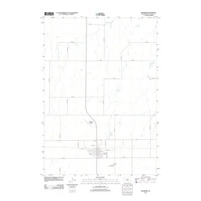
2012 Map of Highmore
USGS Topo · Published 2012About this map
Highmore serves as the central hub of this prairie landscape, where a rigid grid of agricultural roads like 337th Ave and 192nd St meets the more detailed street plan of the town. The residential and commercial blocks are organized around thoroughfares such as Charles St, King Ave, and Ash Ave. This 2012 survey illustrates the community's infrastructure, from the Highmore Municipal Airport situated just north of the main settlement to the civic sites on the southern edge. Local history and genealogy are anchored by two distinct burial grounds, Highmore Cem and the Immaculate Conception Cem, which sit side-by-side south of the town center. The surrounding terrain is marked by seasonal drainage patterns and small depressions characteristic of the Hyde County plains.
Find a feature on this map
27 named features on this map. Tap any name to fly to it.
Don’t see what you’re looking for? This feature index may not catch every label — zoom into the map to look around manually.
Map Details
Editions of this 2012 Highmore Map
This is the sole edition of this map. No revisions or reprints were ever made.
Other maps of this area

1949 · Mitchell Lake
USGS Topo · 1:24,000

1950 · Highmore NE
USGS Topo · 1:24,000

1950 · Mitchell Lake
USGS Topo · 1:24,000

1950 · Highmore
USGS Topo · 1:24,000

1950 · Highmore SE
USGS Topo · 1:24,000

1953 · Huron
USGS Topo · 1:250,000

1954 · Huron
USGS Topo · 1:250,000

1968 · Holabird
USGS Topo · 1:24,000

1968 · Harrold NE
USGS Topo · 1:24,000

1973 · Macs Corner NE
USGS Topo · 1:24,000