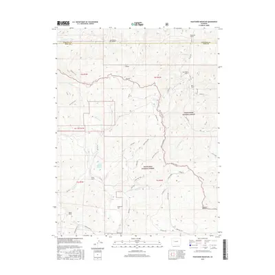
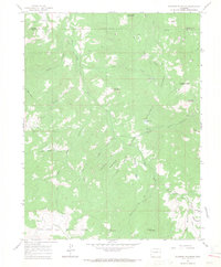
2016 Map of Hightower Mountain
USGS Topo · Published 2016About this map
Grand Mesa National Forest and White River National Forest converge on this high-altitude landscape along the border of Mesa and Garfield Counties. The terrain is defined by a series of dramatic gulches and flats, including Sunflower Flat and Porter Flat, which provided historically significant grazing and transit areas. Water sources are critical in this environment, represented by the Currier Number 2 Reservoir and smaller features like Mud Spring. A complex network of historic routes and modern administrative roads, such as Battlement Trail and the Boundary Road Trail, follow the ridgelines and creek drainages. The southern portion of the map is dominated by the prominence of Hightower Mountain, while the drainage of Buzzard Cr cuts through the western sections. This map documents the intersection of public land management and the natural geography of the Western Slope's interior ranges.
Find a feature on this map
47 named features on this map. Tap any name to fly to it.
Don’t see what you’re looking for? This feature index may not catch every label — zoom into the map to look around manually.
Map Details
Editions of this 2016 Hightower Mountain Map
This is the sole edition of this map. No revisions or reprints were ever made.
Other maps of this area
1955 · The Meadows
USGS Topo · 1:24,000

1957 · Leadville
USGS Topo · 1:250,000

1959 · Leadville
USGS Topo · 1:250,000
1960 · Leadville
USGS Topo · 1:250,000
1960 · North Mamm Peak
USGS Topo · 1:24,000
1960 · South Mamm Peak
USGS Topo · 1:24,000
1961 · Porter Mountain
USGS Topo · 1:24,000
1961 · Spruce Mountain
USGS Topo · 1:24,000
1962 · Leadville
USGS Topo · 1:250,000
1963 · Flatiron Mountain
USGS Topo · 1:24,000