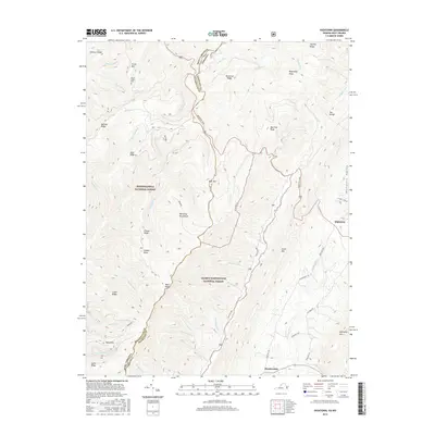
2016 Map of Hightown
USGS Topo · Published 2016About this map
Monongahela National Forest and George Washington National Forest meet along the high-elevation border of West Virginia and Virginia in this 2016 survey. The terrain is dominated by parallel ridges including Lantz Mtn, Bear Mtn, and Frank Mtn, with The Divide serving as a significant hydrographic boundary. The headwaters of the Jackson River and the Little River originate here, carving through the high valleys. Settlement is concentrated along the historic Mountain Tpke and Meadowdale Rd, where the small communities of Hightown and Meadowdale are situated. To the north, the isolated Mount Hobart Cem sits on the slopes of Frank Mtn, while the Bluegrass Valley opens up to the east of Hightown. This map illustrates the intersection of Appalachian wilderness management and the enduring rural road networks of Highland County.
Find a feature on this map
55 named features on this map. Tap any name to fly to it.
Don’t see what you’re looking for? This feature index may not catch every label — zoom into the map to look around manually.
Map Details
Editions of this 2016 Hightown Map
This is the sole edition of this map. No revisions or reprints were ever made.
Other maps of this area

1889 · Beverly
USGS Topo · 1:125,000

1892 · Beverly
USGS Topo · 1:125,000

1901 · Monterey
USGS Topo · 1:125,000

1922 · Spruce Knob
USGS Topo · 1:48,000

1922 · Cass
USGS Topo · 1:48,000

1922 · Durbin
USGS Topo · 1:48,000

1924 · Cass
USGS Topo · 1:62,500

1924 · Durbin
USGS Topo · 1:62,500

1924 · Spruce Knob
USGS Topo · 1:62,500

1941 · Monterey
USGS Topo · 1:62,500