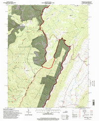
1995 Map of Hightown
USGS Topo · Published 1998About this map
Alleghany Mountain serves as the dividing line for this mountain landscape, marking the high-altitude boundary between Pocahontas County, West Virginia, and Highland County, Virginia. The map documents a significant intersection of public lands, where the Monongahela National Forest meets the George Washington National Forest. Settlement is concentrated along the lower elevations of the Jackson River valley and near the gap at Hightown. Genealogists may find interest in the scattered rural cemeteries and the site of Top of Allegheny Camp Allegheny situated along the ridge. The terrain is defined by a series of parallel ridges including Lantz Mountain and Buffalo Ridge, with drainage systems like Back Creek and Laurel Fork cutting through the narrow valleys, illustrating the complex hydrology of the high Alleghenies in the mid-1990s.
Find a feature on this map
58 named features on this map. Tap any name to fly to it.
Don’t see what you’re looking for? This feature index may not catch every label — zoom into the map to look around manually.
Map Details
Editions of this 1995 Hightown Map
This is the sole edition of this map. No revisions or reprints were ever made.
Other maps of this area

1889 · Beverly
USGS Topo · 1:125,000

1892 · Beverly
USGS Topo · 1:125,000

1901 · Monterey
USGS Topo · 1:125,000

1922 · Spruce Knob
USGS Topo · 1:48,000

1922 · Cass
USGS Topo · 1:48,000

1922 · Durbin
USGS Topo · 1:48,000

1924 · Cass
USGS Topo · 1:62,500

1924 · Durbin
USGS Topo · 1:62,500

1924 · Spruce Knob
USGS Topo · 1:62,500

1941 · Monterey
USGS Topo · 1:62,500