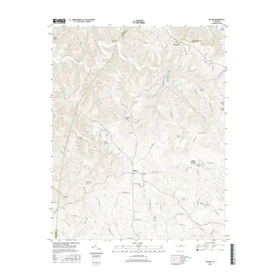
2016 Map of Hilham
USGS Topo · Published 2016About this map
Hilham serves as a central junction in this part of Overton County, where the topography transitions from the high elevations of Goodpasture Mtn and Wilson Mtn down toward the drainages of Mill Creek and Flat Creek. The landscape is heavily marked by family history, evidenced by numerous small burial sites such as the Hawkins Family Cem and the uniquely named Johnie Humpy Brown Cem. To the north, the terrain gives way to the waters of Dale Hollow Lake and Standingstone Lake, which define the recreational and hydrologic character of the border between Overton and Clay counties. This 2016 survey documents a network of rural roads, including Old Standing Stone Rd and Turkey Town Rd, that follow the winding ridgelines and hollows of the Highland Rim, reflecting generations of upland settlement and movement.
Find a feature on this map
99 named features on this map. Tap any name to fly to it.
Don’t see what you’re looking for? This feature index may not catch every label — zoom into the map to look around manually.
Map Details
Editions of this 2016 Hilham Map
This is the sole edition of this map. No revisions or reprints were ever made.
Other maps of this area

1897 · Standingstone
USGS Topo · 1:125,000

1898 · Standingstone
USGS Topo · 1:125,000

1924 · Lillydale
USGS Topo · 1:62,500

1925 · Gainesboro
USGS Topo · 1:62,500

1926 · Lillydale
USGS Topo · 1:62,500

1929 · Lillydale
USGS Topo · 1:62,500

1929 · Gainesboro
USGS Topo · 1:62,500

1929 · Tompkinsville
USGS Topo · 1:62,500

1944 · Livingston
USGS Topo · 1:24,000

1951 · Windle
USGS Topo · 1:24,000