
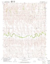
2012 Map of Hill City North
USGS Topo · Published 2012About this map
Smithfield and Roscoe anchor this rural Graham County landscape, characterized by the expansive section-line road grid typical of the High Plains. The terrain is defined by the drainage systems of Coon Cr and Spring Cr, which cut through the agricultural blocks in the northern and central portions of the quadrangle. For genealogists and local historians, the presence of the Hill City Cem and Roscoe Cem provides specific points of interest for tracing early families in this part of Kansas. The southern edge of the map is dominated by the Hill City Municipal Airport and Airport Rd, marking a transition from the quiet agricultural settlements of the north to the modern infrastructure serving the nearby county seat.
Find a feature on this map
17 named features on this map. Tap any name to fly to it.
Don’t see what you’re looking for? This feature index may not catch every label — zoom into the map to look around manually.
Map Details
Editions of this 2012 Hill City North Map
This is the sole edition of this map. No revisions or reprints were ever made.
Other maps of this area

1893 · Norton
USGS Topo · 1:125,000

1893 · Hill
USGS Topo · 1:125,000

1955 · Beloit
USGS Topo · 1:250,000

1959 · Beloit
USGS Topo · 1:250,000

1978 · Lenora East
USGS Topo · 1:24,000

1978 · Edmond SE
USGS Topo · 1:24,000

1979 · Bogue
USGS Topo · 1:24,000
1979 · Logan SW
USGS Topo · 1:24,000

1979 · Hill City South
USGS Topo · 1:24,000

1979 · Penokee
USGS Topo · 1:24,000