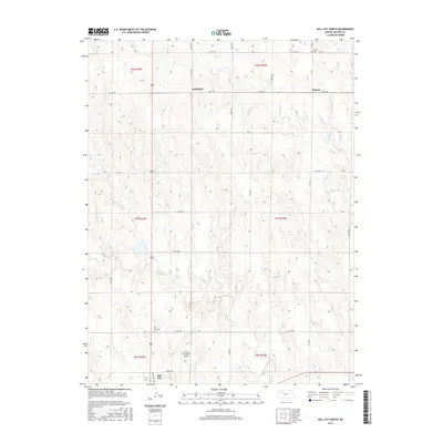
2015 Map of Hill City North
USGS Topo · Published 2015About this map
Coon Creek and Spring Creek define the drainage of this Graham County landscape, where the rural settlements of Smithfield and Roscoe sit among a grid of section-line roads. The area exhibits a classic High Plains settlement pattern, with small communities and family burial grounds such as Roscoe Cemetery situated along primary routes like County Road 380. At the southern edge of the survey, the northern outskirts of Hill City come into view, marked by the Hill City Cemetery and the Hill City Municipal Airport. This 2015 edition provides a modern record of land divisions and local infrastructure, including the Industrial Drive corridor, while maintaining the historical nomenclature of original prairie townships and rural roads that have served these agricultural communities for generations.
Find a feature on this map
29 named features on this map. Tap any name to fly to it.
Don’t see what you’re looking for? This feature index may not catch every label — zoom into the map to look around manually.
Map Details
Editions of this 2015 Hill City North Map
This is the sole edition of this map. No revisions or reprints were ever made.
Other maps of this area

1893 · Norton
USGS Topo · 1:125,000

1893 · Hill
USGS Topo · 1:125,000

1955 · Beloit
USGS Topo · 1:250,000

1959 · Beloit
USGS Topo · 1:250,000

1978 · Lenora East
USGS Topo · 1:24,000

1978 · Edmond SE
USGS Topo · 1:24,000

1979 · Bogue
USGS Topo · 1:24,000
1979 · Logan SW
USGS Topo · 1:24,000

1979 · Hill City South
USGS Topo · 1:24,000

1979 · Penokee
USGS Topo · 1:24,000