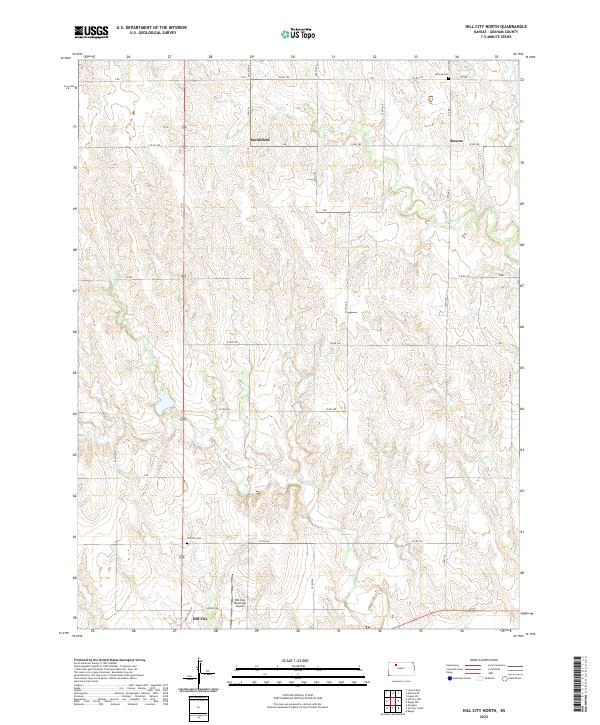
2022 Map of Hill City North
USGS Topo · Published 2022About this map
Hill City serves as the focal point of this Graham County landscape, where the town's northern reaches meet the rural plains of western Kansas. The local landscape is defined by the winding paths of Coon Cr and Spring Cr, which cut through the terrain and influence the placement of early settlements and family burial grounds. Notable landmarks for genealogists and local historians include the Hill City Cem located just north of the city limits and the Roscoe Cem situated near the intersection of ZZ Rd and Co Rd 370.
Find a feature on this map
28 named features on this map. Tap any name to fly to it.
Don’t see what you’re looking for? This feature index may not catch every label — zoom into the map to look around manually.
Map Details
Editions of this 2022 Hill City North Map
This is the sole edition of this map. No revisions or reprints were ever made.
Other maps of this area

1893 · Norton
USGS Topo · 1:125,000

1893 · Hill
USGS Topo · 1:125,000

1955 · Beloit
USGS Topo · 1:250,000

1959 · Beloit
USGS Topo · 1:250,000

1978 · Lenora East
USGS Topo · 1:24,000

1978 · Edmond SE
USGS Topo · 1:24,000

1979 · Bogue
USGS Topo · 1:24,000
1979 · Logan SW
USGS Topo · 1:24,000

1979 · Hill City South
USGS Topo · 1:24,000

1979 · Penokee
USGS Topo · 1:24,000