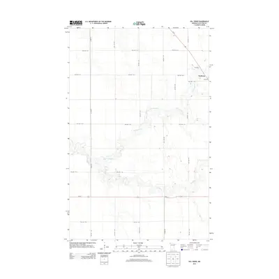
2013 Map of Hill Siding
USGS Topo · Published 2013About this map
Northcote and the rail-oriented settlement of Hill Siding anchor the eastern edge of this Kittson County landscape, situated where the glacial lake plains of the Red River Valley transition into a network of prairie riparian corridors. The hydrology is dominated by the wandering path of the N Br Two Rivers and the main stem of Two Rivers, which cut through the flat agricultural grid in the southern half of the quadrangle. Transport and trade are defined by the linear corridors of Us-75 and the railroad, which parallel the historic Red River oxcart trails. The map reveals a highly structured township road system, including routes like MN-175 and Co Hwy-16, which provide access to the vast agricultural sections that have defined this corner of Minnesota since the late 19th century.
Find a feature on this map
26 named features on this map. Tap any name to fly to it.
Don’t see what you’re looking for? This feature index may not catch every label — zoom into the map to look around manually.
Map Details
Editions of this 2013 Hill Siding Map
This is the sole edition of this map. No revisions or reprints were ever made.
Other maps of this area

1939 · Drayton
USGS Topo · 1:62,500

1939 · Pembina
USGS Topo · 1:62,500

1939 · Kennedy
USGS Topo · 1:62,500

1941 · Kennedy
USGS Topo · 1:62,500

1941 · Drayton
USGS Topo · 1:62,500

1941 · Hallock
USGS Topo · 1:62,500

1941 · Pembina
USGS Topo · 1:62,500

1952 · Thief River Falls
USGS Topo · 1:250,000

1956 · Thief River Falls
USGS Topo · 1:250,000

1957 · Thief River Falls
USGS Topo · 1:250,000