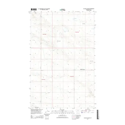
2014 Map of Hilldale Colony
USGS Topo · Published 2014About this map
Hilldale Colony serves as the central hub of this prairie landscape in Hill County, Montana. The terrain is defined by a series of significant drainage features, including Dog Coulee, Willow Coulee, and Staton Coulee, which carve through the high plains. Water management is evident through the presence of McLean Reservoir, while natural basins like Grassy Lake and Mud Lake dot the northern sections of the quadrangle. A structured grid of section lines and rural roads, such as Road 160 N and Road 140 N, organizes the agricultural territory. The inclusion of Amos Trl running north-south provides a glimpse into the local transportation network that connects these remote Hutterite settlements and grazing lands within the Public Land Survey System townships of t36n r15e and t35n r15e.
Find a feature on this map
17 named features on this map. Tap any name to fly to it.
Don’t see what you’re looking for? This feature index may not catch every label — zoom into the map to look around manually.
Map Details
Editions of this 2014 Hilldale Colony Map
This is the sole edition of this map. No revisions or reprints were ever made.
Other maps of this area

1904 · Havre
USGS Topo · 1:62,500

1904 · Assinniboine
USGS Topo · 1:62,500

1912 · Thibedeau Lake
USGS Topo · 1:125,000

1953 · Havre
USGS Topo · 1:250,000

1957 · Havre
USGS Topo · 1:250,000

1958 · Havre
USGS Topo · 1:250,000

1964 · Havre NW
USGS Topo · 1:24,000
1970 · Quigley Coulee
USGS Topo · 1:24,000
1970 · Kiehns Coulee
USGS Topo · 1:24,000

1972 · Hilldale Colony
USGS Topo · 1:24,000