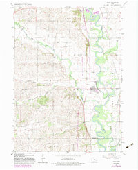
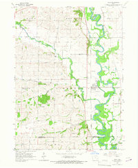
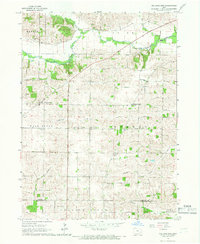
1965 Map of Hills
USGS Topo · Published 1983About this map
The Iowa River snakes through the landscape of Johnson and Washington counties, its meandering path defining the geography of Pleasant Valley and the settlement of Hills. In the mid-1960s, this area maintained a traditional rural character punctuated by landmarks like the University of Iowa Observatory and a cluster of local institutions including St Stanislaus Ch and Sunnyside Sch. The Chicago Rock Island and Pacific railroad parallels the river, serving as a primary corridor for the transport of agricultural goods and local resources.
Find a feature on this map
33 named features on this map. Tap any name to fly to it.
Don’t see what you’re looking for? This feature index may not catch every label — zoom into the map to look around manually.
Map Details
Editions of this 1965 Hills Map
2 editions found
Other maps of this area

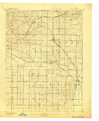
1891 · Iowa City
USGS Topo · 1:62,500
1894 · West Liberty
USGS Topo · 1:62,500

1901 · Stanwood
USGS Topo · 1:125,000

1903 · Fairfax
USGS Topo · 1:125,000
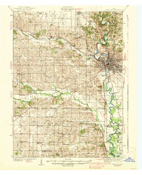
1938 · Iowa City
USGS Topo · 1:62,500

1958 · Davenport
USGS Topo · 1:250,000

1961 · Davenport
USGS Topo · 1:250,000

1962 · Davenport
USGS Topo · 1:250,000
1965 · Williamstown
USGS Topo · 1:24,000
1965 · Tiffin
USGS Topo · 1:24,000