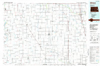
1985 Map of Hillsboro
USGS Topo · Published 1985About this map
The agricultural landscape of the Red River Valley and the eastern North Dakota plains is defined by a rigorous grid of section lines and the prominent corridor of the Burlington Northern railroad. In the mid-1980s, the region's economy and social structure centered on rail towns like Hillsboro, Mayville, and Portland, where the infrastructure for grain transport and local governance concentrated. This survey documents the intricate drainage network vital to the prairie, including the Goose River and the complex system of canals such as Miller Drain and Blanchard Drain that manage the flat terrain. Local history is anchored by sites like Sherbrooke and the Mayville Cem, while conservation areas like the Fullers Lake State Wildlife Management Area and Bald Hill Reservoir provide a contrast to the surrounding farmland.
Find a feature on this map
85 named features on this map. Tap any name to fly to it.
Don’t see what you’re looking for? This feature index may not catch every label — zoom into the map to look around manually.
Map Details
Editions of this 1985 Hillsboro Map
2 editions found
Other maps of this area

1895 · Fargo
USGS Topo · 1:125,000

1895 · Casselton
USGS Topo · 1:125,000

1897 · Fargo
USGS Topo · 1:125,000

1897 · Tower
USGS Topo · 1:125,000

1897 · Eckelson
USGS Topo · 1:125,000

1897 · Casselton
USGS Topo · 1:125,000

1918 · Kelso
USGS Topo · 1:62,500

1918 · Hendrum
USGS Topo · 1:62,500

1919 · Eldred
USGS Topo · 1:62,500

1943 · Kelso
USGS Topo · 1:62,500