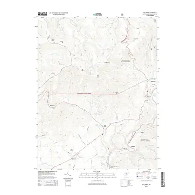
2014 Map of Hillsboro
USGS Topo · Published 2014About this map
Hillsboro and the fertile valley of Little Levels anchor this pocket of West Virginia, where the terrain transitions from high mountain ridges to productive farmland. The landscape is defined by its complex hydrology, featuring numerous named springs such as McNeil Farm Spring, Beard Spring, and Blue Spring that feed into the Stamping Cr and Greenbrier River systems. To the west and north, the high elevations of the Monongahela National Forest dominate, including landmarks like Cranberry Mtn and the Cranberry Glades Overlook. A network of rural routes, including Us 219 and WV 39, connects historic crossroads such as Mill Point, Buckeye, and Seebert. The southern edge of the map features the Thomas C. Edgar Memorial Bridge, reflecting the importance of river crossings in this deeply carved river-and-ridge environment.
Find a feature on this map
74 named features on this map. Tap any name to fly to it.
Don’t see what you’re looking for? This feature index may not catch every label — zoom into the map to look around manually.
Map Details
Editions of this 2014 Hillsboro Map
This is the sole edition of this map. No revisions or reprints were ever made.
Other maps of this area

1891 · Huntersville
USGS Topo · 1:125,000

1894 · Huntersville
USGS Topo · 1:125,000

1915 · Webster Springs
USGS Topo · 1:48,000

1918 · Webster Springs
USGS Topo · 1:62,500

1923 · Lobelia
USGS Topo · 1:48,000

1923 · Marlinton
USGS Topo · 1:48,000

1923 · Mingo
USGS Topo · 1:48,000

1925 · Mingo
USGS Topo · 1:62,500

1925 · Marlinton
USGS Topo · 1:62,500

1925 · Lobelia
USGS Topo · 1:62,500