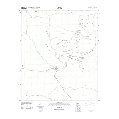
2010 Map of Hillsboro
USGS Topo · Published 2010About this map
The Hillsboro Historic District sits at the heart of this landscape, marking a concentration of residential and civic history along the banks of Percha Creek. This region of Sierra County is defined by its extensive mineral heritage, evidenced by the dense cluster of claims within the Lake Valley Mining District. Prospectors and historians can trace numerous named sites including the Empire Mine and the Rattlesnake Placers, while more specialized industrial efforts are represented by the Vanadinite Mine and the curiously named National Defense Department Number One. The terrain transitions from the heights of Empire Peak down into the narrow passage of The Box. Arroyos and canyons like Greyback Arroyo and Warm Springs Canyon carve through the mesa land, highlighting the geological complexity that once drove the local boom-and-bust economy.
Find a feature on this map
81 named features on this map. Tap any name to fly to it.
Don’t see what you’re looking for? This feature index may not catch every label — zoom into the map to look around manually.
Map Details
Editions of this 2010 Hillsboro Map
This is the sole edition of this map. No revisions or reprints were ever made.
Other maps of this area

1935 · Hillsboro
USGS Topo · 1:48,000

1940 · Hillsboro
USGS Topo · 1:62,500

1954 · Tularosa
USGS Topo · 1:250,000

1955 · Las Cruces
USGS Topo · 1:250,000

1958 · Las Cruces
USGS Topo · 1:250,000

1958 · Tularosa
USGS Topo · 1:250,000

1961 · Skute Stone Arroyo
USGS Topo · 1:24,000

1961 · Saladone Tank
USGS Topo · 1:24,000

1961 · Clark Spring Canyon
USGS Topo · 1:24,000

1963 · Bell Mountain
USGS Topo · 1:24,000