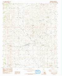
1985 Map of Hillsboro
USGS Topo · Published 1985About this map
The settlement of Hillsboro serves as the focal point of this mid-1980s landscape, situated along the banks of Percha Creek. The geography is defined by a dense network of mining activity, with numerous Mine and Prospect labels scattered across the high ground, particularly near Empire Peak and Black Peak. To the north, Copper Mines and intensive Strip Mine operations underscore the industrial importance of the district.
Find a feature on this map
27 named features on this map. Tap any name to fly to it.
Don’t see what you’re looking for? This feature index may not catch every label — zoom into the map to look around manually.
Map Details
Editions of this 1985 Hillsboro Map
This is the sole edition of this map. No revisions or reprints were ever made.
Other maps of this area

1935 · Hillsboro
USGS Topo · 1:48,000

1940 · Hillsboro
USGS Topo · 1:62,500

1954 · Tularosa
USGS Topo · 1:250,000

1955 · Las Cruces
USGS Topo · 1:250,000

1958 · Las Cruces
USGS Topo · 1:250,000

1958 · Tularosa
USGS Topo · 1:250,000

1961 · Skute Stone Arroyo
USGS Topo · 1:24,000

1961 · Saladone Tank
USGS Topo · 1:24,000

1961 · Clark Spring Canyon
USGS Topo · 1:24,000

1963 · Bell Mountain
USGS Topo · 1:24,000