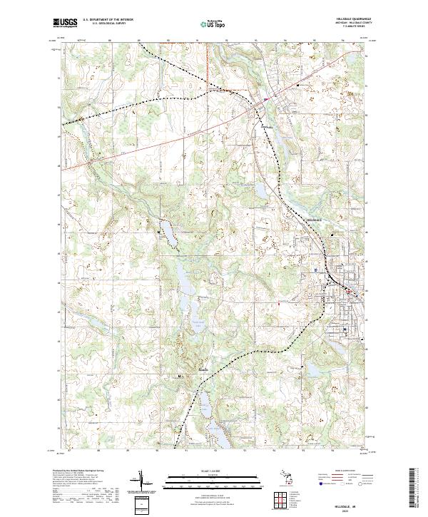
2023 Map of Hillsdale
USGS Topo · Published 2023About this map
The Saint Joseph River winds through the heart of northern Hillsdale County, connecting the historic communities of Jonesville and Hillsdale. This area of southern Michigan exhibits a complex glacial topography characterized by numerous kettle lakes and wetland basins, including North Sand Lake, South Sand Lake, and Lake Wilson. The industrial and educational foundations of the region are clearly visible, with the campus of Hillsdale College and the Hillsdale County Courthouse serving as central landmarks. A network of local roads and recreational paths, such as the North Country National Scenic Tr, intersects with the small settlement of Bankers and various rural cemeteries like Oak Grove Cem and Sunset View Cem, which offer significant value for genealogical research.
Find a feature on this map
143 named features on this map. Tap any name to fly to it.
Don’t see what you’re looking for? This feature index may not catch every label — zoom into the map to look around manually.
Map Details
Editions of this 2023 Hillsdale Map
This is the sole edition of this map. No revisions or reprints were ever made.
Other maps of this area

1948 · Spring Arbor
USGS Topo · 1:62,500

1948 · Homer
USGS Topo · 1:62,500

1949 · Homer
USGS Topo · 1:62,500

1949 · Spring Arbor
USGS Topo · 1:62,500

1953 · Fort Wayne
USGS Topo · 1:250,000

1956 · Fort Wayne
USGS Topo · 1:250,000

1958 · Grand Rapids
USGS Topo · 1:250,000

1959 · Hillsdale
USGS Topo · 1:24,000

1959 · Reading
USGS Topo · 1:24,000

1959 · North Adams
USGS Topo · 1:24,000