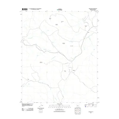
2011 Map of Hillside
USGS Topo · Published 2011About this map
Hillside and Yava serve as the primary focal points of this 2011 survey, situated within a topography of drainages and peaks in Yavapai County. The settlement of Hillside is positioned at the base of Hillside Peak, where Weekes Ranch Rd and Pecks Peak Rd converge. Further north, the settlement of Yava sits along Ally Wash, near where the terrain transitions into the Thompson Valley. The map documents a complex hydrological network essential to this arid environment, including Mine Tank, Carter Flat Spring, and the S Fork Santa Maria Riv. To the west, the McCloud Mountains rise above Lawler Creek, while the northern reaches are dominated by Bismark Mountain and the distinct Wild Hog Basin. This topographical record captures the modern footprint of ranching access roads and isolated water sources that have historically sustained these high-desert communities.
Find a feature on this map
36 named features on this map. Tap any name to fly to it.
Don’t see what you’re looking for? This feature index may not catch every label — zoom into the map to look around manually.
Map Details
Editions of this 2011 Hillside Map
This is the sole edition of this map. No revisions or reprints were ever made.
Other maps of this area

1887 · Prescott
USGS Topo · 1:250,000

1892 · Prescott
USGS Topo · 1:250,000

1903 · Congress
USGS Topo · 1:125,000

1904 · Congress
USGS Topo · 1:125,000

1923 · Signal
USGS Topo · 1:250,000

1942 · Signal
USGS Topo · 1:250,000

1945 · Bagdad
USGS Topo · 1:62,500

1947 · Sheridan Mountain
USGS Topo · 1:62,500

1948 · Sheridan Mountain
USGS Topo · 1:63,360

1948 · Bagdad
USGS Topo · 1:62,500