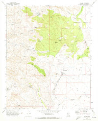
1969 Map of Hillside
USGS Topo · Published 1973About this map
The Atchison Topeka and Santa Fe railroad corridor anchors this late 1960s topographic survey of Yavapai County, passing through the small settlement of Hillside. This high-desert landscape is defined by the McCloud Mountains and the prominent Thompson Peak, which overlooks the expansive Thompson Valley. Water management was clearly central to life in this arid region, as evidenced by a network of vital points including Sweetwater Well, Quail Spring, and Mine Tank.
Find a feature on this map
32 named features on this map. Tap any name to fly to it.
Don’t see what you’re looking for? This feature index may not catch every label — zoom into the map to look around manually.
Map Details
Editions of this 1969 Hillside Map
This is the sole edition of this map. No revisions or reprints were ever made.
Other maps of this area

1887 · Prescott
USGS Topo · 1:250,000

1892 · Prescott
USGS Topo · 1:250,000

1903 · Congress
USGS Topo · 1:125,000

1904 · Congress
USGS Topo · 1:125,000

1923 · Signal
USGS Topo · 1:250,000

1942 · Signal
USGS Topo · 1:250,000

1945 · Bagdad
USGS Topo · 1:62,500

1947 · Sheridan Mountain
USGS Topo · 1:62,500

1948 · Sheridan Mountain
USGS Topo · 1:63,360

1948 · Bagdad
USGS Topo · 1:62,500