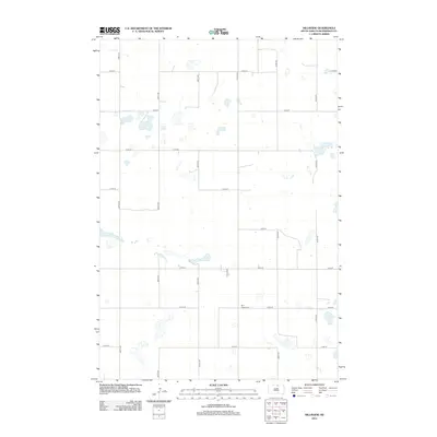
2012 Map of Hillsview
USGS Topo · Published 2012About this map
Saint Joseph Cem serves as a primary historical anchor for this rural McPherson County landscape, situated along the intersection of 120th St and 331st Ave. The map reveals a strictly regulated section-line road network, where long straightaways such as 329th Ave and 334th Ave crisscross the prairie at precise intervals. Small pockets of water and wetlands are scattered across the terrain, reflecting the natural drainage patterns of the northern plains. The small cluster of development near Main St N and 119th St indicates the focal point of the local community, while the surrounding area remains defined by open space and a traditional agricultural grid. This survey provides a clear view of the rural infrastructure and land divisions as they existed in the early twenty-first century.
Find a feature on this map
17 named features on this map. Tap any name to fly to it.
Don’t see what you’re looking for? This feature index may not catch every label — zoom into the map to look around manually.
Map Details
Editions of this 2012 Hillsview Map
This is the sole edition of this map. No revisions or reprints were ever made.
Other maps of this area

1954 · Aberdeen
USGS Topo · 1:250,000

1956 · Aberdeen
USGS Topo · 1:250,000

1978 · Hillsview SE
USGS Topo · 1:24,000

1978 · Hosmer NW
USGS Topo · 1:24,000

1978 · Bowdle-Hosmer Lake
USGS Topo · 1:24,000

1978 · Eureka West
USGS Topo · 1:24,000

1978 · Feinstein Lake
USGS Topo · 1:24,000

1978 · Eureka East
USGS Topo · 1:24,000

1978 · Hosmer
USGS Topo · 1:24,000

1978 · Schumacher Lake SW
USGS Topo · 1:24,000