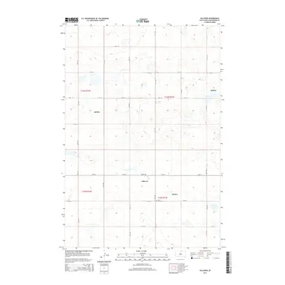
2015 Map of Hillsview
USGS Topo · Published 2015About this map
Hillsview sits at the center of this McPherson County landscape, serving as a quiet focal point within the organized grid of the Public Land Survey System. The township boundaries of t125n r72w and its neighbors define a classic Midwestern agricultural pattern of section lines and gravel roads like Powell Ave and 331st Ave. A significant local landmark, the Saint Joseph Cem provides a genealogical touchstone for the community, situated just south of the main settlement. The map also identifies several areas designated as Mcwpa, which dot the landscape alongside numerous prairie potholes and small water bodies characteristic of the region's topography. This 2015 survey reflects the enduring rural character of northern South Dakota, where the placement of cemeteries and local roads preserves the historical footprint of early homesteading and settlement.
Find a feature on this map
22 named features on this map. Tap any name to fly to it.
Don’t see what you’re looking for? This feature index may not catch every label — zoom into the map to look around manually.
Map Details
Editions of this 2015 Hillsview Map
This is the sole edition of this map. No revisions or reprints were ever made.
Other maps of this area

1954 · Aberdeen
USGS Topo · 1:250,000

1956 · Aberdeen
USGS Topo · 1:250,000

1978 · Hillsview SE
USGS Topo · 1:24,000

1978 · Hosmer NW
USGS Topo · 1:24,000

1978 · Bowdle-Hosmer Lake
USGS Topo · 1:24,000

1978 · Eureka West
USGS Topo · 1:24,000

1978 · Feinstein Lake
USGS Topo · 1:24,000

1978 · Eureka East
USGS Topo · 1:24,000

1978 · Hosmer
USGS Topo · 1:24,000

1978 · Schumacher Lake SW
USGS Topo · 1:24,000