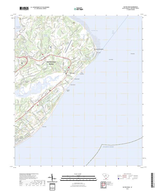
2024 Map of Hilton Head
USGS Topo · Published 2024About this map
Hilton Head Island is intricately detailed in this contemporary look at its coastal geography and dense residential infrastructure. The landscape is defined by the winding waters of Broad Creek and the Intracoastal Waterway, which separate the island's many named developments and golf courses from the South Carolina mainland. Established landmarks and historical markers remain prominent among the modern growth, including the Zion Chapel Church Graveyard and several family or plantation burial grounds such as Talbird Cem and the Honey Horn Plantation Cem.
Find a feature on this map
80 named features on this map. Tap any name to fly to it.
Don’t see what you’re looking for? This feature index may not catch every label — zoom into the map to look around manually.
Map Details
Editions of this 2024 Hilton Head Map
This is the sole edition of this map. No revisions or reprints were ever made.
Other maps of this area

1920 · Okatie
USGS Topo · 1:62,500

1920 · Hilton Head
USGS Topo · 1:62,500

1920 · Bluffton
USGS Topo · 1:62,500

1942 · Okatie
USGS Topo · 1:62,500

1944 · Fort Fremont
USGS Topo · 1:62,500

1945 · Bluffton
USGS Topo · 1:62,500

1945 · Hilton Head
USGS Topo · 1:62,500

1947 · Savannah
USGS Topo · 1:250,000

1948 · Savannah
USGS Topo · 1:250,000
1955 · Savannah Beach North
USGS Topo · 1:24,000
Featured Places
- Hilton Head Island, SC
- Palmetto Dunes, Hilton Head Island
- Port Royal, Hilton Head Island
- Hilton Head Plantation, Hilton Head Island
- Indigo Run, Hilton Head Island