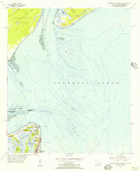
1955 Map of Savannah Beach North
USGS Topo · Published 1956About this map
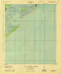
Fort Screven and the Tybee Lighthouse stand as prominent maritime and military landmarks at the entrance to the Savannah River during the mid-1950s. This survey illustrates the intricate coastal geography where South Carolina and Georgia meet, capturing the shifting sands of Tybee Knoll Spit and the protective alignment of the North Jetty and South Jetty. To the north, the tip of Daufuskie Island features Bloody Point, while the southern reaches of Hilton Head Island appear across the Calibogue Sound. The residential and military footprint on Tybee Island is clearly delineated, showing the community of Savannah Beach and its local landmarks, including a Cem and various structures along the tidal marshlands of Crab Creek and Chimney Creek.
Find a feature on this map
30 named features on this map. Tap any name to fly to it.
Don’t see what you’re looking for? This feature index may not catch every label — zoom into the map to look around manually.
Map Details
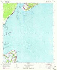
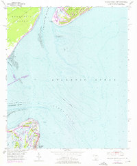
Editions of this 1955 Savannah Beach North Map
3 editions found
Other maps of this area
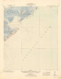
1920 · Wassaw Sound
USGS Topo · 1:62,500

1920 · Hilton Head
USGS Topo · 1:62,500

1920 · Bluffton
USGS Topo · 1:62,500

1945 · Bluffton
USGS Topo · 1:62,500

1945 · Hilton Head
USGS Topo · 1:62,500
1945 · Wassaw Sound
USGS Topo · 1:62,500

1946 · Brunswick
USGS Topo · 1:250,000

1947 · Savannah
USGS Topo · 1:250,000

1948 · Brunswick
USGS Topo · 1:250,000

1948 · Savannah
USGS Topo · 1:250,000