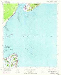
1955 Map of Savannah Beach North
USGS Topo · Published 1972About this map
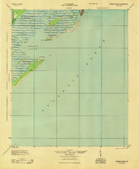
Fort Screven and the northern tip of Tybee Island anchor this coastal survey, where the Savannah River meets the Atlantic Ocean. The map captures the maritime strategic importance of the mouth of the river, marked by the Tybee Lighthouse and the protective North Jetty and South Jetty structures. To the north across the Tybee Roads, the southernmost points of Daufuskie Island and Hilton Head Island are visible at Bloody Point and Braddock Point.
Find a feature on this map
32 named features on this map. Tap any name to fly to it.
Don’t see what you’re looking for? This feature index may not catch every label — zoom into the map to look around manually.
Map Details
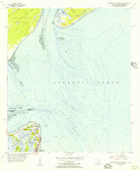
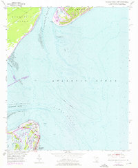
Editions of this 1955 Savannah Beach North Map
3 editions found
Other maps of this area
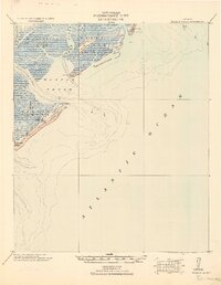
1920 · Wassaw Sound
USGS Topo · 1:62,500

1920 · Hilton Head
USGS Topo · 1:62,500

1920 · Bluffton
USGS Topo · 1:62,500

1945 · Bluffton
USGS Topo · 1:62,500

1945 · Hilton Head
USGS Topo · 1:62,500
1945 · Wassaw Sound
USGS Topo · 1:62,500

1946 · Brunswick
USGS Topo · 1:250,000

1947 · Savannah
USGS Topo · 1:250,000

1948 · Brunswick
USGS Topo · 1:250,000

1948 · Savannah
USGS Topo · 1:250,000