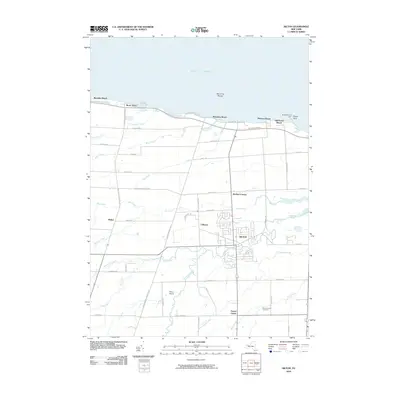
2010 Map of Hilton
USGS Topo · Published 2010About this map
The village of Hilton serves as the focal point of this Monroe County landscape, situated where several branches of Salmon Creek converge before flowing toward the lake. To the north, the shoreline of Lake Ontario is punctuated by residential lakefront communities such as Shore Acres, Wautoma Beach, and Lighthouse Beach, with the Braddock Point Light marking a critical navigational point near Bogus Point. The interior terrain is defined by a systematic grid of rural roads, connecting small established settlements like Collamer, Walker, and Parma Center. Local aviation is represented by the Hilton Airport located south of the main village, while the Parma Union Cemetery provides a genealogical touchstone for the surrounding community. Numerous waterways, including Buttonwood Creek and Black Creek, drain the agricultural lands that lie between the lakefront and the southern interior, illustrating the area's hydrology and settlement patterns in the early 21st century.
Find a feature on this map
57 named features on this map. Tap any name to fly to it.
Don’t see what you’re looking for? This feature index may not catch every label — zoom into the map to look around manually.
Map Details
Editions of this 2010 Hilton Map
This is the sole edition of this map. No revisions or reprints were ever made.
Other maps of this area

1895 · Rochester
USGS Topo · 1:62,500

1895 · Ontario Beach
USGS Topo · 1:62,500

1898 · Rochester
USGS Topo · 1:62,500

1899 · Hamlin
USGS Topo · 1:62,500

1899 · Ontario Beach
USGS Topo · 1:62,500

1899 · Brockport
USGS Topo · 1:62,500

1912 · Rochester
USGS Topo · 1:62,500

1912 · Ontario Beach
USGS Topo · 1:62,500

1920 · Rochester
USGS Topo · 1:62,500

1931 · Rochester West
USGS Topo · 1:24,000