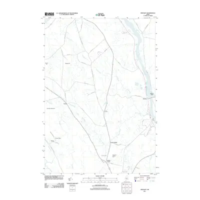
2011 Map of Hinckley
USGS Topo · Published 2011About this map
The Kennebec River corridor defines this Somerset County landscape, where the historical hamlet of Hinckley and the river-crossing at Pishon Ferry mark traditional points of commerce and transit. Further inland, smaller agricultural and residential clusters like Larone, North Fairfield, and Holway Corner are linked by a network of rural roads such as Wentworth Orchard Rd and Back Rd. The map reveals a community-centered geography anchored by the Good Will Homes and several long-established burial grounds, including Covell Cemetery, Friend Cemetery, and Tozier Cemetery.
Find a feature on this map
51 named features on this map. Tap any name to fly to it.
Don’t see what you’re looking for? This feature index may not catch every label — zoom into the map to look around manually.
Map Details
Editions of this 2011 Hinckley Map
This is the sole edition of this map. No revisions or reprints were ever made.
Other maps of this area

1892 · Waterville
USGS Topo · 1:62,500

1894 · Norridgewock
USGS Topo · 1:62,500

1898 · Norridgewock
USGS Topo · 1:62,500

1904 · Anson
USGS Topo · 1:62,500

1913 · Skowhegan
USGS Topo · 1:62,500

1943 · Norridgewock
USGS Topo · 1:62,500

1943 · Waterville
USGS Topo · 1:62,500

1948 · Bangor
USGS Topo · 1:250,000

1955 · Anson
USGS Topo · 1:62,500

1955 · Skowhegan
USGS Topo · 1:62,500