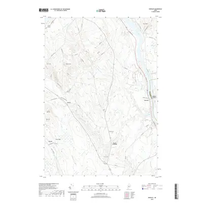
2018 Map of Hinckley
USGS Topo · Published 2018About this map
The Kennebec River carves a deep valley through this Maine landscape, serving as the boundary between Kennebec and Somerset counties. The village of Hinckley sits along the western bank, marked by the historic crossing at Pishon Ferry. To the west, the terrain rises toward significant heights like Bigelow Hill, Burrill Hill, and Bear Mtn, while Martin Stream and its tributaries such as Lost Brook drain the interior valleys.
Find a feature on this map
57 named features on this map. Tap any name to fly to it.
Don’t see what you’re looking for? This feature index may not catch every label — zoom into the map to look around manually.
Map Details
Editions of this 2018 Hinckley Map
This is the sole edition of this map. No revisions or reprints were ever made.
Other maps of this area

1892 · Waterville
USGS Topo · 1:62,500

1894 · Norridgewock
USGS Topo · 1:62,500

1898 · Norridgewock
USGS Topo · 1:62,500

1904 · Anson
USGS Topo · 1:62,500

1913 · Skowhegan
USGS Topo · 1:62,500

1943 · Norridgewock
USGS Topo · 1:62,500

1943 · Waterville
USGS Topo · 1:62,500

1948 · Bangor
USGS Topo · 1:250,000

1955 · Anson
USGS Topo · 1:62,500

1955 · Skowhegan
USGS Topo · 1:62,500