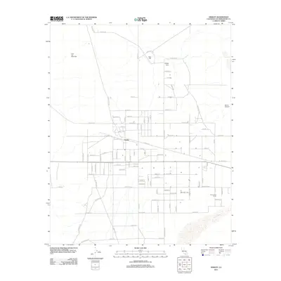
2012 Map of Hinkley
USGS Topo · Published 2012About this map
Hinkley serves as the central hub for this High Desert landscape, where a structured grid of residential streets and rural access roads meets the natural path of the Mojave River. The settlement is defined by its agricultural and communal infrastructure, including the Hinkley Valley Grange and a local Po (Post Office), reflecting a small-town character established long before modern development. To the north and east, the terrain rises sharply into prominent landforms like Lynx Cat Mountain, Red Hill, and Mount General, which provide a stark vertical contrast to the broad expanse of the Hinkley Valley. The map records an intricate network of local thoroughfares such as Santa Fe Ave and Black Canyon Rd, illustrating the intersection of natural riverine geography with the deliberate planning of early-21st-century San Bernardino County.
Find a feature on this map
81 named features on this map. Tap any name to fly to it.
Don’t see what you’re looking for? This feature index may not catch every label — zoom into the map to look around manually.
Map Details
Editions of this 2012 Hinkley Map
This is the sole edition of this map. No revisions or reprints were ever made.
Other maps of this area

1915 · Searles Lake
USGS Topo · 1:250,000

1932 · Barstow
USGS Topo · 1:125,000

1934 · Barstow
USGS Topo · 1:125,000

1947 · Trona
USGS Topo · 1:250,000

1948 · Trona
USGS Topo · 1:250,000

1953 · San Bernardino
USGS Topo · 1:250,000

1953 · Trona
USGS Topo · 1:250,000

1955 · Opal Mountain
USGS Topo · 1:62,500

1956 · San Bernardino
USGS Topo · 1:250,000

1956 · Fremont Peak
USGS Topo · 1:62,500