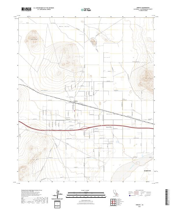
2021 Map of Hinkley
USGS Topo · Published 2021About this map
Hinkley serves as the central hub of this desert landscape, situated within the Hinkley Valley where the grid of local roads meets the northern edge of the Mojave Desert. The map reveals a transition from the agricultural and residential plots around the settlement to the surrounding peaks, including Lynx Cat Mtn to the northwest and Iron Mtn to the southwest. To the north, Water Valley and Red Hill mark the more arid reaches of the quadrangle. The southern portion of the sheet is defined by the course of the Mojave River, which flows near the northwestern outskirts of Barstow. This 2021 survey documents the established road network, such as Santa Fe Ave and Hinkley Rd, that provides access across the valley floor between the distinct mountain ranges of Mt General and the surrounding desert basins.
Find a feature on this map
88 named features on this map. Tap any name to fly to it.
Don’t see what you’re looking for? This feature index may not catch every label — zoom into the map to look around manually.
Map Details
Editions of this 2021 Hinkley Map
This is the sole edition of this map. No revisions or reprints were ever made.
Other maps of this area

1915 · Searles Lake
USGS Topo · 1:250,000

1932 · Barstow
USGS Topo · 1:125,000

1934 · Barstow
USGS Topo · 1:125,000

1947 · Trona
USGS Topo · 1:250,000

1948 · Trona
USGS Topo · 1:250,000

1953 · San Bernardino
USGS Topo · 1:250,000

1953 · Trona
USGS Topo · 1:250,000

1955 · Opal Mountain
USGS Topo · 1:62,500

1956 · San Bernardino
USGS Topo · 1:250,000

1956 · Fremont Peak
USGS Topo · 1:62,500