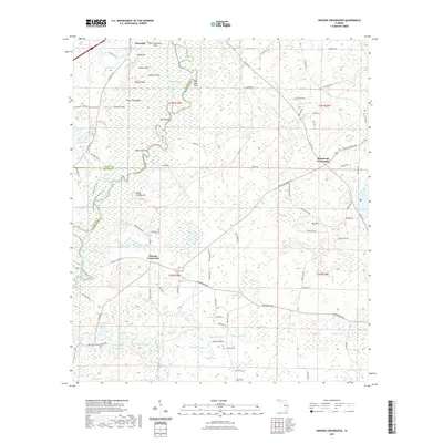
2021 Map of Hinsons Crossroads
USGS Topo · Published 2021About this map
Westville sits at the northern edge of this landscape, where the Choctawhatchee River creates a complex network of waterways including Saved Slough and Old River. The terrain is defined by a dense concentration of wetlands and named fields, suggesting a long history of local agriculture and river-dependent living. Features like Buck Hammock Field, Cooey Field, and Bullet Field indicate specific pockets of cleared land amidst the broader swampy environment.
Find a feature on this map
118 named features on this map. Tap any name to fly to it.
Don’t see what you’re looking for? This feature index may not catch every label — zoom into the map to look around manually.
Map Details
Editions of this 2021 Hinsons Crossroads Map
This is the sole edition of this map. No revisions or reprints were ever made.
Other maps of this area

1948 · Ponce De Leon
USGS Topo · 1:24,000

1949 · Millers Ferry
USGS Topo · 1:24,000

1949 · Redbay
USGS Topo · 1:24,000

1949 · Hinsons Cross Roads
USGS Topo · 1:24,000

1949 · Caryville
USGS Topo · 1:24,000

1950 · Prosperity
USGS Topo · 1:24,000

1950 · Millers Ferry
USGS Topo · 1:24,000

1950 · Ponce De Leon
USGS Topo · 1:24,000

1950 · Hinsons Cross Roads
USGS Topo · 1:24,000

1950 · Redbay
USGS Topo · 1:24,000