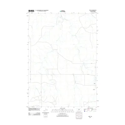
2012 Map of Hisle
USGS Topo · Published 2012About this map
Hisle sits as a quiet settlement in the wide landscape of Bennett County, documented here as it appeared in the early 21st century. The geography is defined by the winding paths of Corn Cr and Bear-in-the-Lodge Cr, which weave through the terrain alongside a network of rural roads. Genealogists and local historians will find the Saint Joseph Cem located just south of the main cluster of buildings at Hisle, providing a specific point of reference for families of the area. The road network, including Bia Rd 9 and Hisle Rd, reflects the importance of Bureau of Indian Affairs routes in connecting these remote residential and agricultural clusters. This topographical record illustrates a persistent pattern of high plains life, where small settlements and watercourses dictate the human footprint.
Find a feature on this map
10 named features on this map. Tap any name to fly to it.
Don’t see what you’re looking for? This feature index may not catch every label — zoom into the map to look around manually.
Map Details
Editions of this 2012 Hisle Map
This is the sole edition of this map. No revisions or reprints were ever made.
Other maps of this area

1950 · Interior SE
USGS Topo · 1:24,000

1950 · Potato Creek
USGS Topo · 1:24,000

1950 · Wanblee
USGS Topo · 1:24,000

1955 · Martin
USGS Topo · 1:250,000

1958 · Martin
USGS Topo · 1:250,000

1980 · Kadoka
USGS Topo · 1:100,000

1981 · Patricia
USGS Topo · 1:25,000

1981 · Allen
USGS Topo · 1:25,000

1981 · Hisle
USGS Topo · 1:25,000
1981 · Buzzard Butte
USGS Topo · 1:25,000