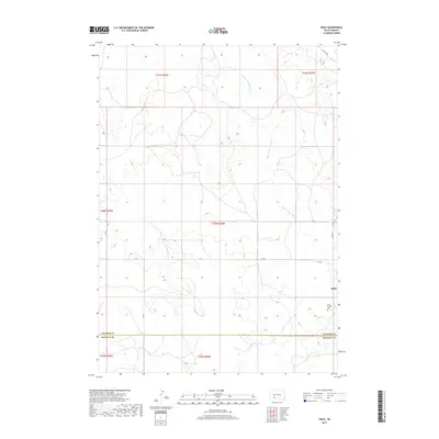
2017 Map of Hisle
USGS Topo · Published 2017About this map
Hisle sits near the eastern edge of this landscape, positioned within a network of tribal and local routes such as Hisle Rd and BIA Rd. The terrain is defined by the winding paths of Corn Cr and Bear-in-the-Lodge Cr, which carve through the high plains across the Jackson Co and Bennett Co line. This 2017 survey shows a rural environment where land use is closely tied to the natural hydrology of the creeks and the established section lines of the Public Land Survey System. Genealogists and local historians can find the Saint Joseph Cem located just south of the main settlement, providing a specific point of reference for the community's history in this part of South Dakota. The map meticulously documents the transition from one county to another, capturing the infrastructure of the Pine Ridge region.
Find a feature on this map
17 named features on this map. Tap any name to fly to it.
Don’t see what you’re looking for? This feature index may not catch every label — zoom into the map to look around manually.
Map Details
Editions of this 2017 Hisle Map
This is the sole edition of this map. No revisions or reprints were ever made.
Other maps of this area

1950 · Interior SE
USGS Topo · 1:24,000

1950 · Potato Creek
USGS Topo · 1:24,000

1950 · Wanblee
USGS Topo · 1:24,000

1955 · Martin
USGS Topo · 1:250,000

1958 · Martin
USGS Topo · 1:250,000

1980 · Kadoka
USGS Topo · 1:100,000

1981 · Patricia
USGS Topo · 1:25,000

1981 · Allen
USGS Topo · 1:25,000

1981 · Hisle
USGS Topo · 1:25,000
1981 · Buzzard Butte
USGS Topo · 1:25,000