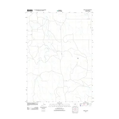
2012 Map of Hisle NW
USGS Topo · Published 2012About this map
Potato Cr winds through this rural landscape north of Kyle, South Dakota, defining the drainage patterns of an area marked by wide-reaching range and scattered watercourses. The terrain is anchored by Snake Butte, a prominent landmark in the central-east portion of the quadrangle. This 2012 survey illustrates a sparse network of roads that service the region, including Allen Rd and Bia Rd, reflecting the remote and agrarian nature of the plains in Oglala Lakota County. To the north, Turtle Cr flows toward the map edge near the intersection of Old School Rd and CS 42. The map provides a precise look at the rural road grid, where designations like CS 41 and CS 41b facilitate movement across a landscape where natural features like the creek beds still dictate the primary geographic boundaries.
Find a feature on this map
10 named features on this map. Tap any name to fly to it.
Don’t see what you’re looking for? This feature index may not catch every label — zoom into the map to look around manually.
Map Details
Editions of this 2012 Hisle NW Map
This is the sole edition of this map. No revisions or reprints were ever made.
Other maps of this area

1950 · Interior SE
USGS Topo · 1:24,000

1950 · Potato Creek
USGS Topo · 1:24,000

1952 · Conata SE
USGS Topo · 1:24,000

1955 · Hot Springs
USGS Topo · 1:250,000

1955 · Martin
USGS Topo · 1:250,000

1958 · Martin
USGS Topo · 1:250,000

1980 · Kadoka
USGS Topo · 1:100,000

1981 · Wall
USGS Topo · 1:100,000

1981 · Yellow Bear Camp
USGS Topo · 1:25,000

1981 · Allen
USGS Topo · 1:25,000