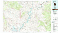
1980 Map of Hite Crossing
USGS Topo · Published 1987About this map
The Henry Mountains, including Mount Pennell and Mount Hillers, dominate the western portion of this 1980 survey, which captures the high-desert landscape of southern Utah during a period of transition. The Colorado River corridor is defined by the expansive waters of Lake Powell, reaching deep into side canyons like Halls Creek Bay and Cataract Canyon. This edition reflects the area's development as a destination within the Glen Canyon National Recreation Area, showing established sites at Bullfrog and the emerging settlement at Ticaboo.
Find a feature on this map
82 named features on this map. Tap any name to fly to it.
Don’t see what you’re looking for? This feature index may not catch every label — zoom into the map to look around manually.
Map Details
Editions of this 1980 Hite Crossing Map
This is the sole edition of this map. No revisions or reprints were ever made.
Other maps of this area

1885 · San Rafael
USGS Topo · 1:250,000

1885 · La Sal
USGS Topo · 1:250,000

1885 · Fish Lake
USGS Topo · 1:250,000

1886 · Escalante
USGS Topo · 1:250,000

1886 · Henry Mountains
USGS Topo · 1:250,000

1886 · Abajo
USGS Topo · 1:250,000

1892 · Abajo
USGS Topo · 1:250,000

1892 · Henry Mountains
USGS Topo · 1:250,000

1893 · Abajo
USGS Topo · 1:250,000

1896 · Fish Lake
USGS Topo · 1:250,000