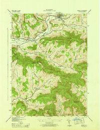
1946 Map of Hobart
USGS Topo · Published 1946About this map
The West Branch Delaware River carves through the Catskill uplands of Delaware County, centering on the village of Hobart and the dairy-rich valleys of Kortright and Bovina. In the mid-1940s, the New York Central railroad remains a vital artery, tracing the river's edge through South Kortright toward the peak of Mt Bob. The landscape is defined by its deep hollows and high summits, including Lyon Mtn, Mt Warren, and Plattekill Mtn. Rural life is anchored by local institutions like South Kortright Central School and several numbered schoolhouses, while the topography dictates a network of winding passages such as Narrow Notch and Carmans Notch. The mapping reveals the proximity of family farms to prominent landmarks like Crescent Valley and Town Brook Valley, showing the tight-knit settlement pattern of these mountain townships before modern highway expansion shifted the region's character.
Find a feature on this map
45 named features on this map. Tap any name to fly to it.
Don’t see what you’re looking for? This feature index may not catch every label — zoom into the map to look around manually.
Map Details
Editions of this 1946 Hobart Map
This is the sole edition of this map. No revisions or reprints were ever made.
Other maps of this area

1901 · Margaretville
USGS Topo · 1:62,500

1904 · Hobart
USGS Topo · 1:62,500

1904 · Margaretville
USGS Topo · 1:62,500

1909 · Delhi
USGS Topo · 1:62,500

1911 · Delhi
USGS Topo · 1:62,500

1922 · Andes
USGS Topo · 1:62,500

1924 · Andes
USGS Topo · 1:62,500

1943 · Bloomville
USGS Topo · 1:24,000
1943 · Davenport
USGS Topo · 1:24,000
1945 · Davenport
USGS Topo · 1:31,680