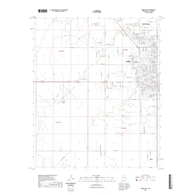
2023 Map of Hobbs West
USGS Topo · Published 2023About this map
Hobbs and its surrounding residential expansions form the core of this western New Mexico survey, revealing a landscape defined by its grid-pattern development and aviation infrastructure. The western edge of the city limits meets the Lea County Regional Airport, while established neighborhoods such as North Hobbs and the settlement of Nadine to the south anchor the local geography. The map provides significant detail for genealogists, documenting the Boone Cem - Memorial Park Cem and Memorial Gardens Cem. A dense network of thoroughfares, including W Bender Blvd and the South Byp, illustrates the logistical layout of this high plains community. Outside the concentrated streets of the city, the terrain is marked by township lines like t18s r37e and t19s r38e, where the land transitions into more open territory punctuated by local landmarks like W Stanolind Rd.
Find a feature on this map
164 named features on this map. Tap any name to fly to it.
Don’t see what you’re looking for? This feature index may not catch every label — zoom into the map to look around manually.
Map Details
Editions of this 2023 Hobbs West Map
This is the sole edition of this map. No revisions or reprints were ever made.
Other maps of this area

1954 · Hobbs
USGS Topo · 1:250,000

1958 · Hobbs
USGS Topo · 1:250,000

1962 · Lovington
USGS Topo · 1:62,500

1963 · Monument
USGS Topo · 1:62,500

1969 · Humble City
USGS Topo · 1:24,000

1969 · Hobbs SW
USGS Topo · 1:24,000

1969 · Hobbs East
USGS Topo · 1:24,000

1969 · Hobbs SE
USGS Topo · 1:24,000

1969 · Hobbs West
USGS Topo · 1:24,000

1969 · Humble City SE
USGS Topo · 1:24,000