
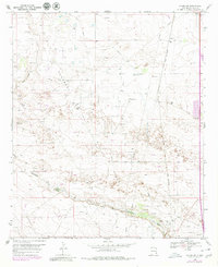
1969 Map of Hobbs SW
USGS Topo · Published 1971About this map
Monument Jal Field dominates the industrial landscape of this 1969 topographic study, revealing a complex network of oil wells and pipelines throughout Lea County. This era in southeast New Mexico was defined by the intersection of energy extraction and transport, marked by the prominent path of the Texas - New Mexico railroad line and a large aqueduct cutting across the terrain. Small settlements like Warren and Nadine punctuate the grid, providing residential anchors for the surrounding workforce. The natural topography is characterized by the White Breaks and the winding course of Monument Draw in the south, where a Carbon Plant and numerous Gravel Pits indicate active resource processing. For those tracing local heritage, the Monument Cem serves as a vital genealogical landmark situated amidst the shifting sands and industrial infrastructure of the Permian Basin.
Find a feature on this map
11 named features on this map. Tap any name to fly to it.
Don’t see what you’re looking for? This feature index may not catch every label — zoom into the map to look around manually.
Map Details
Editions of this 1969 Hobbs SW Map
2 editions found
Other maps of this area

1954 · Hobbs
USGS Topo · 1:250,000

1958 · Hobbs
USGS Topo · 1:250,000

1963 · Oil Center
USGS Topo · 1:62,500

1963 · Monument
USGS Topo · 1:62,500

1969 · Hobbs East
USGS Topo · 1:24,000

1969 · Eunice
USGS Topo · 1:24,000

1969 · Hobbs SE
USGS Topo · 1:24,000

1969 · Eunice NE
USGS Topo · 1:24,000

1969 · Hobbs West
USGS Topo · 1:24,000

1978 · Jal
USGS Topo · 1:100,000