
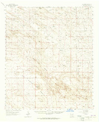
1963 Map of Oil Center
USGS Topo · Published 1964About this map
The Monument Jal Oil Field and surrounding petroleum grounds dominate this 1963 study of Lea County's arid landscape. The map reveals an industrial economy laid over an unforgiving terrain, where the San Simon Ridge and San Simon Swale provide the primary geographical structure. Water management is the defining human element here, seen in the numerous basins and tanks such as Urssey Tank, Flood Tank, and Rainy Tank, alongside the more substantial Rock Lake Reservoir.
Find a feature on this map
22 named features on this map. Tap any name to fly to it.
Don’t see what you’re looking for? This feature index may not catch every label — zoom into the map to look around manually.
Map Details
Editions of this 1963 Oil Center Map
2 editions found
Other maps of this area

1954 · Hobbs
USGS Topo · 1:250,000

1958 · Hobbs
USGS Topo · 1:250,000

1963 · Monument
USGS Topo · 1:62,500

1963 · Laguna Gatuna
USGS Topo · 1:62,500

1963 · Hat Mesa
USGS Topo · 1:62,500

1969 · Hobbs SW
USGS Topo · 1:24,000

1969 · Eunice
USGS Topo · 1:24,000

1969 · Jal NW
USGS Topo · 1:24,000

1969 · Rattlesnake Canyon
USGS Topo · 1:24,000

1973 · Bell Lake
USGS Topo · 1:24,000