
1969 Map of Eunice
USGS Topo · Published 1972About this map
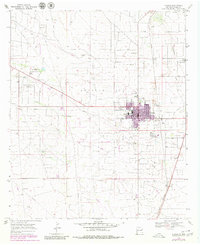
Eunice serves as the focal point of this late-1960s survey, illustrating a community deeply integrated with the surrounding Monument Jal Oil Field. The landscape is a working industrial grid, dominated by numerous Oil Wells, a sprawling network of pipelines, and a specialized infrastructure that includes a Gas Plant, Substa, and a Radio Tower. While the oil industry defines the region's economy, the map also captures the town's social life through features like the Drive-in Theater, Rodeo Ground, and the Eunice Municipal Recreation Area featuring a golf course.
Find a feature on this map
30 named features on this map. Tap any name to fly to it.
Don’t see what you’re looking for? This feature index may not catch every label — zoom into the map to look around manually.
Map Details
Editions of this 1969 Eunice Map
2 editions found
Other maps of this area

1954 · Hobbs
USGS Topo · 1:250,000

1958 · Hobbs
USGS Topo · 1:250,000

1963 · Oil Center
USGS Topo · 1:62,500

1963 · Monument
USGS Topo · 1:62,500

1969 · Hobbs SW
USGS Topo · 1:24,000

1969 · Hobbs SE
USGS Topo · 1:24,000

1969 · Eunice NE
USGS Topo · 1:24,000

1969 · Eunice SE
USGS Topo · 1:24,000

1969 · Rattlesnake Canyon
USGS Topo · 1:24,000

1978 · Jal
USGS Topo · 1:100,000