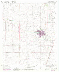
1969 Map of Eunice
USGS Topo · Published 1980About this map
Eunice dominates the high plains of the Monument Jal Oil Field in this late 1960s survey, showing a landscape deeply shaped by the petroleum industry. Numerous oil wells, pipelines, and a prominent Gas Plant surround the residential center, illustrating the economic drivers of Lea County during this era. The town infrastructure includes a High Sch, a Cem, and specialized local landmarks like the Rodeo Ground and a Drive-in Theater.
Find a feature on this map
27 named features on this map. Tap any name to fly to it.
Don’t see what you’re looking for? This feature index may not catch every label — zoom into the map to look around manually.
Map Details
Editions of this 1969 Eunice Map
2 editions found
Other maps of this area

1954 · Hobbs
USGS Topo · 1:250,000

1958 · Hobbs
USGS Topo · 1:250,000

1963 · Oil Center
USGS Topo · 1:62,500

1963 · Monument
USGS Topo · 1:62,500

1969 · Hobbs SW
USGS Topo · 1:24,000

1969 · Eunice
USGS Topo · 1:24,000

1969 · Hobbs SE
USGS Topo · 1:24,000

1969 · Eunice NE
USGS Topo · 1:24,000

1969 · Eunice SE
USGS Topo · 1:24,000

1969 · Rattlesnake Canyon
USGS Topo · 1:24,000