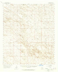
1963 Map of Oil Center
USGS Topo · Published 1965About this map
The Monument Oil Field and Wilson Oil Field dominate this 1963 topographical survey of the Permian Basin, showing a landscape defined by industrial development. The network of oil wells, pipelines, and unimproved roads centers on the settlement of Oil Center, reflecting the mid-century energy boom in Lea County. Beyond the derricks, the map reveals a rugged natural basin featuring the San Simon Swale and the prominent San Simon Ridge. Water management in this arid environment is clearly documented through numerous man-made and natural features, including Rock Lake Reservoir, North Lake, and the deep depression of the San Simon Sink. Smaller landmarks like the San Simon Ranch and scattered quarries provide specific touchpoints for local historians and land use researchers studying the intersection of ranching and the petroleum industry.
Find a feature on this map
25 named features on this map. Tap any name to fly to it.
Don’t see what you’re looking for? This feature index may not catch every label — zoom into the map to look around manually.
Map Details
Editions of this 1963 Oil Center Map
2 editions found
Other maps of this area

1954 · Hobbs
USGS Topo · 1:250,000

1958 · Hobbs
USGS Topo · 1:250,000

1963 · Oil Center
USGS Topo · 1:62,500

1963 · Monument
USGS Topo · 1:62,500

1963 · Laguna Gatuna
USGS Topo · 1:62,500

1963 · Hat Mesa
USGS Topo · 1:62,500

1969 · Hobbs SW
USGS Topo · 1:24,000

1969 · Eunice
USGS Topo · 1:24,000

1969 · Jal NW
USGS Topo · 1:24,000

1969 · Rattlesnake Canyon
USGS Topo · 1:24,000